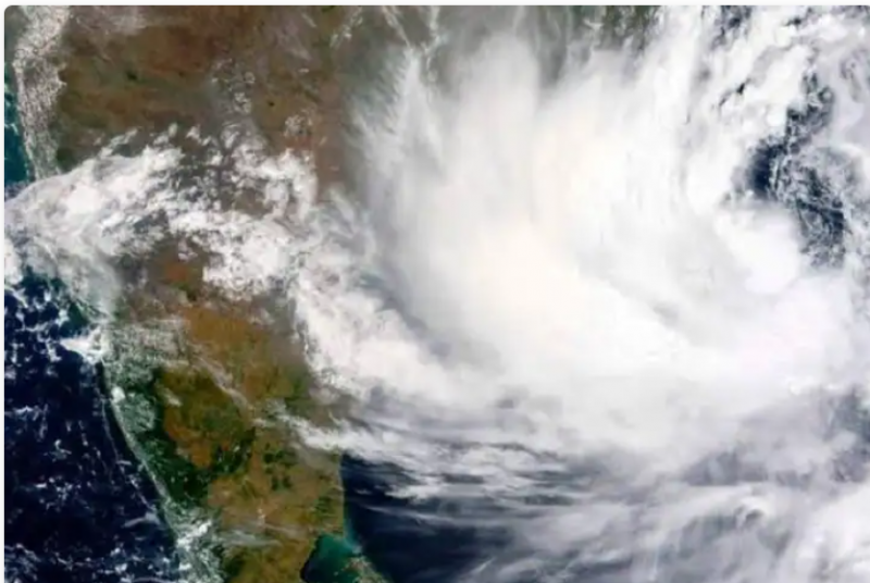
New Delhi: 'Jawad' is the name of a cyclonic storm originating in the Bay of Bengal. It is likely to bring very heavy rainfall with strong winds in many districts of South Bengal as it is active. A defence officer has said that the Coast Guard has started taking steps to protect life and property at sea. Ships and aircraft have been engaged in warning about the weather. The West Bengal government has said it has decided to deploy two teams of National Disaster Response Force and two teams of State Disaster Response Force in the coastal area. As well as people living in the lower areas are being shifted to other places.
How dangerous is cyclone Jawad?: The Met department has said that the low air pressure forming in the Southeast Bay of Bengal is expected to turn into a deep depression followed by a cyclonic storm. Where the West Central Bay of Bengal, north Andhra Pradesh coast-south Odisha coast are expected to arrive on Saturday morning. The Met department has also said that the impact will bring heavy to very heavy rainfall at one or 2 places in east Midnapore on Saturday, while heavy rainfall is expected in western Midnapore, Jhargram and Howrah.
Why was this storm named 'Jawad'?: Where it is revealed that the storm has been named 'Jawad' at the suggestion of Saudi Arabia. Jawad is an Arabic word which means 'liberal'. It is being said that the cyclone will not cause much havoc as compared to the earlier cyclonic storms and is not going to have much impact on normal life. However, the IMD, the Indian Meteorological Department, has said that the wind speed will be a maximum of 100 kmph on the morning of December 4.
Omicron has changed appearance 53 times in just 9 days
Covid Roundup: India logs 9,216 cases, active cases up to 99,976