The Indian Meteorological Department (IMD) has predicted that most parts of India are going to experience above-normal temperatures and an increase in heatwave days between the months of March and May. According to IMD, both maximum as well as the minimum temperatures across the country will remain above normal, sparing only the extreme north, peninsular and northeast India.
The regions likely to face scorching heat include Rajasthan, Gujarat, Haryana, Punjab, Madhya Pradesh, Maharashtra, Uttar Pradesh, Bihar, Jharkhand, West Bengal, Odisha, Chhattisgarh, Telangana, Andhra Pradesh, and north Karnataka.
This follows after what was the warmest February on record in India since 1901. The mean monthly temperature this February was 22.04 degree Celsius, which was 1.34 degree Celsius higher than the Long Period Average (LPA) that makes it the warmest February in 124 years. The last highest mean temperature in February in India was in 2016 recorded at 21.99 degree Celsius. The shocking revelation suggests that “spring may have all but vanished this year.”
India’s average monthly maximum temperature last month was 29.07 degrees, that is 1.49 degrees above normal. This also makes it the warmest February in terms of daytime temperatures, only behind the average 29.44 degrees recorded in 2023. Moreover, the night time temperatures even set a new record, with average monthly minimum of 15.02 degree Celsius, which is 1.2 degrees higher than the LPA. The previous highest minimum in February was in 2016 at 14.91 degree Celsius.
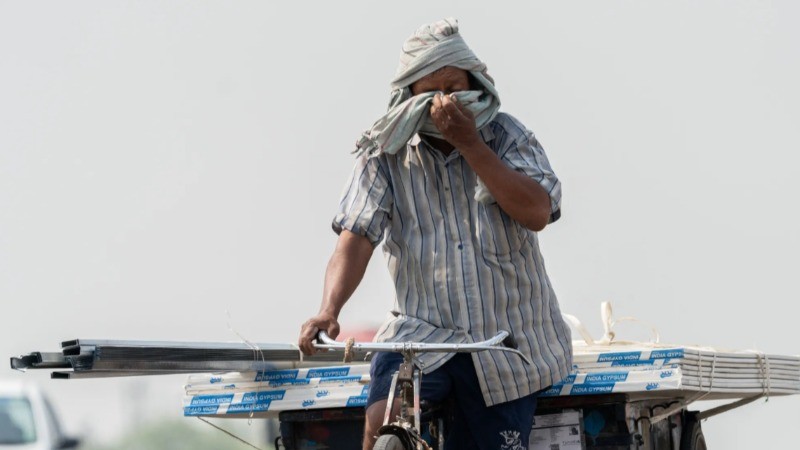
The warm February is very much in sync with the ongoing weather patterns recently. Delhi recorded its warmest February night in 74 years this Thursday. The capital city’s minimum temperatures surged to 19.5 degree Celsius, that is seven degrees above the normal. Mumbai and other coastal areas of Maharashtra, Gujarat and Karnataka along with Goa are already recording high temperatures. On 26th February, Mumbai recorded a maximum temperature at 38.7 degree Celsius, which is 5.9 degree Celsius above the normal average. Even if the heatwave recedes for a while, hot and humid weather conditions will persist for the next couple of days.
The unusual heat witnessed is very much linked to the behavior of western disturbances. IMD attributes it to bring cooler temperatures to north India in winters. India observed seven disturbances in February this year as compared to the five to six normally. However, this moved in a quick succession, and did not have sufficient moisture. They could only result in light rains or snowfall. Only the latest western disturbance is strong enough, rest all feeble.
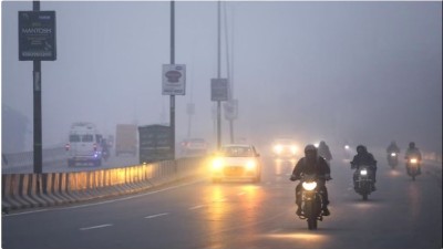
Also, the cold waves were almost absent in the Northern plains this February. As mentioned earlier, the night temperatures being warmer than usual in the north and central India. Even fog missed across most parts of the Indo-Gangetic plains.
IMD’s forecast further reveals that normal rainfall will be experienced across the country. The LPA for rainfall in March from 1971 to 2020 is 29.9 mm. For this March, the rainfall is expected to be 83% to 117% of the LPA. Above normal rainfall is likely over most parts of Peninsular India and the nearby regions of south of Central India. Rest of the country is likely to have below normal rainfall.
It has been noted that at present, there are weak La Nina conditions which are expected to weaken further as March progresses ahead until May. ENSO conditions are likely to occur in the monsoon season until the end of the year. The model forecasts indicate a temperature increase but it is highly unlikely of EI Nino conditions.
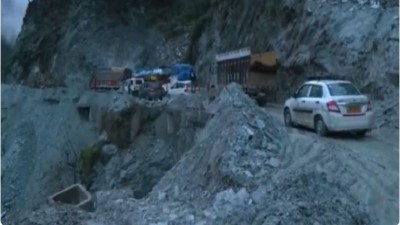
Well, as of now, a large part of northwest India is experiencing an active western disturbance, which is resulting in widespread rains and snowfall. The parts of Jammu Kashmir- Ladakh- Gilgit- Baltistan- Muzaffarabad, Himachal Pradesh and Uttarakhand have recorded heavy to vary heavy rainfall, followed by extremely heavy rain spells. The wet spell will continue until March 3, the northwest India will then have a weak western disturbance in the second week of the month. The Western Himalayan region will have scattered to widespread rainfall, with likely snowfall.
The country has witnessed one of the most dry winter seasons, with rains remained in hiding. It is not only in India, but the global weather patterns are also going through similar, rise in temperatures, scorching heatwave further resulting in heatwaves. It is also said that the temperature rise is more likely due to the human-caused climate change…Weather records will continue to break, until we limit the greenhouse gas emissions. The frequent change in weather patterns is not always due to the natural disturbances, but more so because of the human caused damage.