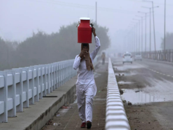
NEW DELHI: The India Meteorological Department (IMD) on Saturday said that dense to very dense fog will continue over the northern states of Delhi, Punjab, Haryana, Chandigarh, Uttar Pradesh and Rajasthan till February 21, adding that the intensity will reduce thereafter.
A fresh western disturbance is likely to affect Jammu and Kashmir, Ladakh, Gilgit, Baltistan and Muzaffarabad from Saturday onwards. Under its influence, light to moderate isolated to scattered rainfall and snowfall is likely.
Fog engulfed the region and visibility was recorded at 500 meters or less in the morning. The visibility was 500 meters at Delhi's Safdarjung area, Haryana's Ganganagar and Ambala. It was 200 meters at Hisar in Haryana and 25 meters at Amritsar, Patiala and Palam. "Improvement in Palam airport visibility, at 9 a.m. it is 50 meters. Visibility of runway 28 and 29 is only 200 meters. We expect flight delay and flight cancellation," Mahesh Palawat, from private weather forecasting agency Skymet Weather in the morning.
Safdarjung weather monitoring stations, which provide representative data for the city, recorded a minimum of 10.4 degrees Celsius as against 9.6 on Friday. Palam station registered a minimum of 12 degrees Celsius. The mercury is on a gradual rise.
Notably, another western disturbance, in quick succession, is likely to affect these western Himalayan regions from Monday. This will also bring scattered rainfall and snowfall with isolated thunderstorms, lightning and hail over the region.
US special envoy praises PM Modi's efforts on climate change
Daily surge in new COVID-19 cases: Kerala, Maharashtra, MP, Punjab, Chhattisgarh
Illegal Drug use and crime: BJP youth leader Pamela Goswami arrested in Kolkata