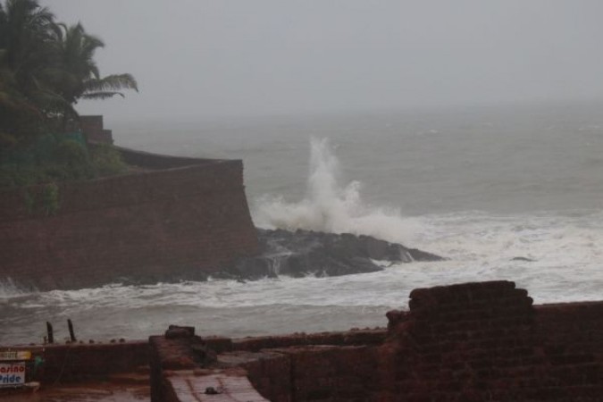
Kolkata: Cyclonic storm prevention has intensified due to the pressure on the southwest Bay of West Bengal. It is located 410 km east-southeast of Puducherry and 450 km southeast of Chennai. This information was given by the country's meteorological department on Tuesday. According to the Meteorological Department, this severe cyclonic storm is expected to intensify in the coming 24 hours.
According to IMD, it will cross the coast of Tamil Nadu and Puducherry between Karaikal and Mamallapuram around 8 pm on Wednesday at a speed of 100-110 kmph. According to the Meteorological Department, the speed of the wind is expected to reach 80-90 kmph, which has moved off the coast of South-West Bay of Bengal and Puducherry in Tamil Nadu on Tuesday.
Winds are expected to flow along the Bay of South-West Bengal and along Tamil Nadu and Puducherry on Wednesday with wind speeds of 100-110 kmph and gusts up to 120 kmph. The sea conditions are expected to be very volatile in these areas. Hence fishermen are advised not to go to these sea areas during this period.
#WATCH पुडुचेरी के गांधी बीच से दृश्य।
— ANI_HindiNews (@AHindinews) November 24, 2020
भारत मौसम विज्ञान विभाग के अनुसार #NivarCyclone 25 नवंबर, 2020 की शाम कराईकल और ममल्लापुरम के बीच तमिलनाडु और पुडुचेरी के तटों को पार कर सकता है। pic.twitter.com/cf6VTINtib
Also Read-
Consider Pusa bio-decomposer for Stubble burning: Gopal Rai
No sense to consider Pfizer vaccine as the Co is yet to get approval in the US: Harsh Vardhan
Mamta Banerjee demands due GST amount in meeting with PM Modi