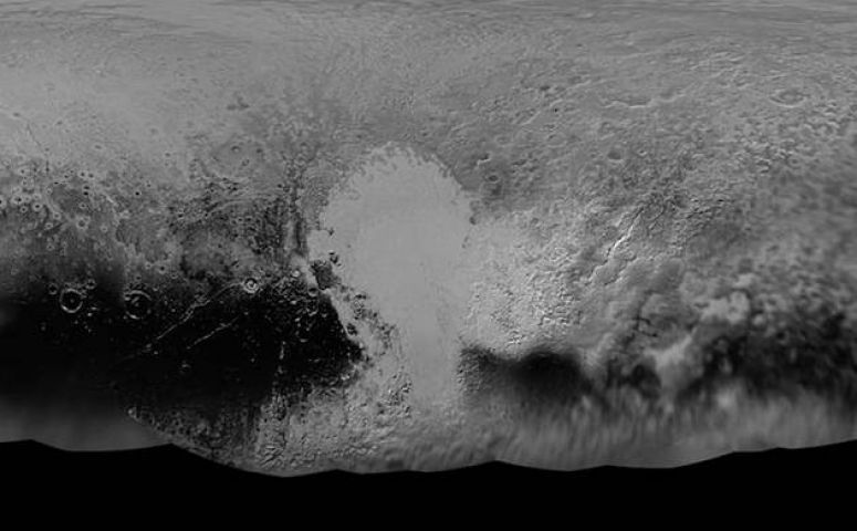
NASA’s New Horizons mission science team has produced this updated black-and-white global map of Pluto.
The map includes all resolved images of Pluto’s surface acquired between July 7-14, 2015, at pixel resolutions ranging from 18 miles (30 kilometers) on the Charon-facing hemisphere (left and right edges of the map) to 770 feet (235 meters) on the hemisphere facing New Horizons (map center)
NASA has released a picture that provides the most detailed look at Pluto that we have seen ever.
"The team will continue to add photos as the spacecraft transmits the rest of its stored Pluto encounter data," NASA said in a statement. "All encounter imagery is expected on Earth by early fall."