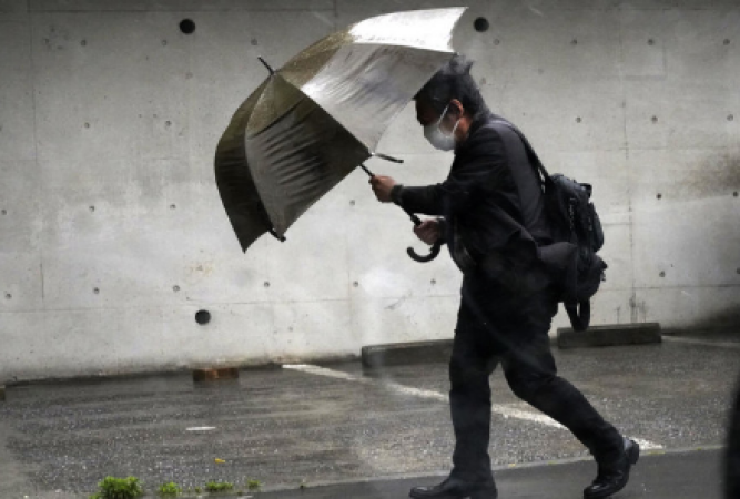
Naha: Tropical Storm-intensified heavy rains Mawar struck the main archipelago of Japan on Friday, stopping trains and public transport and posing a flood and mudslide risk in the south and west.
Up to 35 centimetres of rain were predicted to fall over the course of the next 24 hours through Saturday morning in some areas of western and central Japan, prompting warnings. Residents in at-risk areas, such as those in Wakayama, Kochi in the west, and Nagano in the centre of Japan, were informed that flooding and mudslides could occur and advised to seek shelter in evacuation centres if at all possible.
In Wakayama city's residential areas, television footage showed swollen rivers, including one where brown water rose as high as the bottom of a bridge over it.
Also Read: London protest by asylum seekers against "inhumane" hotel conditions
The few people walking on the rain-soaked streets of Tokyo clutched umbrellas as wind-whipped tree branches. Some schools in Tokyo also decided to cancel their afternoon sessions.
According to the Central Japan Railway Co., heavy rain caused Shinkansen super-express trains between Tokyo and Okayama in western Japan to be cancelled or delayed. In southern Japan, flights and ferries were also cancelled because of the persistently strong winds.
Also Read: Vladimir Putin's arrest at the BRICS summit is avoided by South Africa
Although Mawar was well offshore in the Pacific Ocean, its winds were strong enough to injure people as it passed Okinawa. In Nishihara city, a senior citizen who fell suffered a serious head injury, while seven other people only suffered minor wounds.
According to the Japan Meteorological Agency, the tropical storm had sustained winds of up to 82 kph and was moving east-northeast at a speed of 25 kph on Friday afternoon. It was about 1,500 kilometres southwest of Tokyo, close to Amami-Oshima Island.
According to the meteorological agency, a linear band of heavy rain was hovering over the islands as the tropical storm's warm, humid air intensified seasonal rains.
Earlier this week, Mawar mostly avoided Taiwan and the Philippines. Although no significant damage was reported, it brought heavy rain to the northern Philippines and sent waves crashing into Taiwan's east coast.
Also Read: Governor: Two people are killed by Russian shelling in the region of Zaporizhzhia in Ukraine
The most powerful typhoon to strike Guam in more than 20 years was Mawar. According to the Federal Emergency Management Agency, only 28% of the power had been restored as of Wednesday, and only about 50% of the water system was up and running.
Authorities predict it will take four to six weeks before power is fully restored, and there have been long lines for gas. Exactly how many homes were destroyed is still unknown to FEMA.