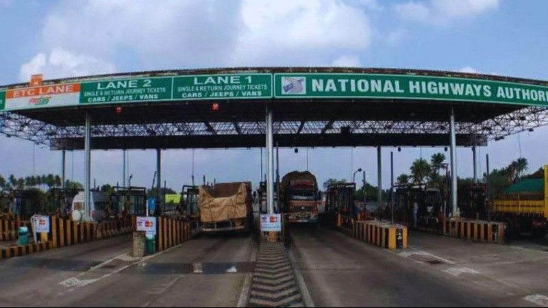
The government is set to introduce a new toll collection system using Global Navigation Satellite System (GNSS) technology next week. This innovative approach will replace traditional toll booths with a more efficient method, initially focusing on trucks and buses.
The GNSS-based toll system utilizes satellites to track vehicle movement and calculate tolls based on the exact distance traveled. Unlike the current FASTag system, which requires vehicles to stop at toll booths, this new system will facilitate continuous travel without physical toll gates. The Ministry of Road Transport and Highways has updated the National Highway Fee Rules to accommodate this technology, which will employ NavIC, India's satellite navigation system.
OBUs and Virtual Toll Booths
Vehicles will be equipped with non-transferable GNSS On-Board Units (OBUs), either installed externally or pre-fitted from the factory. These units will communicate with centralized toll software installed along highways. The OBUs will provide data on distance traveled, which will be used to calculate toll fees. Fintech companies will act as intermediaries, linking OBUs with toll chargers in a manner similar to the FASTag system.
Virtual gantries will be set up on highways to track vehicle entry and exit. These virtual toll booths will gather vehicle information and process toll payments automatically through the existing FASTag system. Real-time toll calculation will be based on vehicle movement through designated toll areas, with users receiving SMS notifications for each deduction.
Initial Rollout and Future Plans - Initially, GNSS toll lanes will be introduced at existing toll plazas to allow seamless passage for equipped vehicles. Over time, more lanes will adopt this technology. The National Highway Authority of India plans to release a bid document within two months, aiming to launch the first phase of commercial satellite-based tolling by April-June 2025.
Technology companies, including TCS, Infosys, and Accenture, have shown interest in developing this system. The rollout will start with trucks, buses, and vehicles carrying hazardous goods, with other commercial vehicles included in the next phase. Private vehicles will be integrated by 2026-27.
Geo-fencing of national highways is nearly complete, marking entry and exit points for accurate toll calculation. The GNSS tolling system will initially cover 2,000 km of highways by June 2025, expanding to 10,000 km in nine months, 25,000 km in 15 months, and 50,000 km within two years.
Toll-Free Travel Up to 20 Km with New GNSS-Based System: Know How It Works
Maharashtra CM Inaugurates New Arch Bridge, Mumbai Travel Time to Reduce...