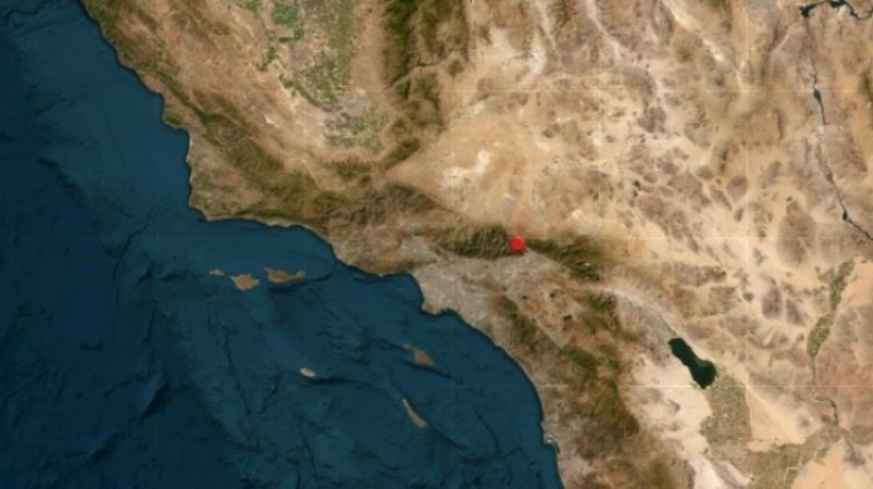
Today, Southern California hit a magnitude-4.2 earthquake striking 1 kilometer WNW of Lytle Creek on January 6th, as per the United States Geological Survey (USGS). The seismic activity occurred at precisely 18:55:54 with a depth recorded at 8.8 kilometers.
The USGS provided coordinates locating the epicenter at Latitude: 34.265°N and Longitude: 117.510°W. This earthquake was flagged as a "Notable quake, preliminary info: M 4.2 - 1 km WNW of Lytle Creek, CA," according to USGS Earthquakes posted on X.
Earlier in the day, USGS Earthquakes had reported a morning earthquake measuring 4.1 in magnitude near Lytle Creek. The report specifically highlighted its closeness to the San Jacinto fault and the San Andreas fault. Moreover, the tweet included a cautionary statement, suggesting a one-in-20 chance of a larger earthquake occurring in the coming days.
The tremors from the magnitude-4.2 earthquake were felt in Southern California at 18:55:54, with its epicenter located at Latitude: 34.265°N and Longitude: 117.510°W, as reported by the United States Geological Survey (USGS). This seismic activity struck 1 kilometer WNW of Lytle Creek at a depth of 8.8 kilometers.
Earlier in the day, USGS Earthquakes had mentioned a separate morning earthquake registering a magnitude of 4.1 near Lytle Creek. This earlier report emphasized its proximity to both the San Jacinto fault and the San Andreas fault. Additionally, the tweet issued a caution, suggesting a one-in-20 likelihood of a larger earthquake occurring in the near future.
Earthquake Strikes Afghanistan: Magnitude 4.3 Jolts Kabul
Japan Earthquake Leaves 62 Dead, Rescue Operations Ongoing: Latest Updates