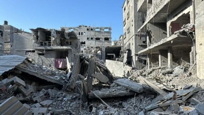
Denpasar, Indonesia: Indonesia's picturesque resort island of Bali and other regions were jolted by a formidable earthquake and subsequent aftershock on Tuesday, stirring panic among residents and tourists. Despite the intense shockwaves, initial reports indicate that there has been no significant damage or casualties.
According to the United States Geological Survey (USGS), the earthquake registered a magnitude of 7.1 and was centered approximately 181 kilometers (112 miles) northeast of Gili Air, a small island situated near the coast of Lombok Island, adjacent to Bali. The earthquake's epicenter lay at a considerable depth of 513.5 kilometers (319 miles).
Indonesia's Meteorology, Climatology, and Geophysical Agency promptly allayed fears of a tsunami while cautioning about potential aftershocks. The agency initially reported the magnitude as 7.4, highlighting the common variations in early measurements of seismic events.
Also Read: Unveiling the Rich Tapestry of India's World Heritage Sites
In the wake of the initial earthquake, a powerful aftershock with a magnitude of 5.4 reverberated through the same region, occurring just before dawn. The seismic activity prompted both residents and tourists to flee their homes and hotels in search of higher ground, seeking safety from the perceived threat. However, a wave of relief spread as text messages reassured them that the earthquake was unlikely to trigger a tsunami.
A tourist from Australia described the panic, sharing, "I thought the walls were going to come down on the hotel," underscoring the intensity of the seismic impact on social media.
The earthquake's effects were not confined solely to Bali. Neighboring provinces, including East Java, Central Java, West Nusa Tenggara, and East Nusa Tenggara, also experienced the tremors, which elicited panic as buildings and houses swayed for several seconds.
Indonesia, a sprawling archipelago comprising 270 million inhabitants, is no stranger to the ravages of natural disasters. Its geographical location within the volatile "Ring of Fire," an arc characterized by active volcanoes and fault lines encircling the Pacific, renders the nation susceptible to earthquakes, volcanic eruptions, and tsunamis.
Also Read: Indices Your Home May Be Haunted, Say Paranormal Experts
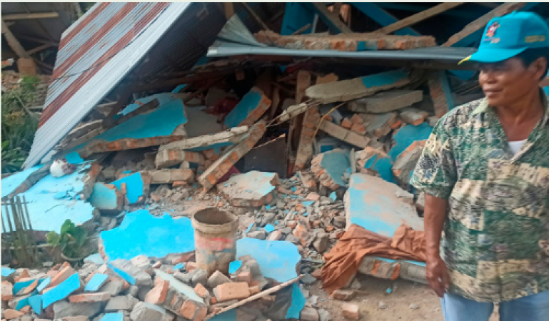
In 2021, an earthquake struck the hilly region of Karangasem, triggering landslides and isolating at least three villages, leading to the loss of three lives.
More significantly, a devastating magnitude 5.6 earthquake on November 21 left a profound impact on West Java's Cianjur city, claiming the lives of at least 331 individuals and injuring close to 600.
This incident stands as Indonesia's deadliest since the catastrophic earthquake and tsunami that struck Sulawesi in 2018, resulting in the loss of approximately 4,340 lives.
Indonesia's history is marked by the harrowing memory of the 2004 Indian Ocean earthquake, an immensely powerful seismic event that triggered a devastating tsunami.
The tsunami wreaked havoc across a dozen countries, causing the tragic loss of more than 230,000 lives, with a significant portion of the casualties concentrated in Indonesia's Aceh province.
Also Read: Rare Video Emerges of US Citizen Paul Whelan in Russian Penal Colony
The recent earthquake serves as a poignant reminder of the nation's ongoing vulnerability to seismic activity and natural disasters. It underscores the vital importance of disaster preparedness, early warning systems, and resilient infrastructure to mitigate the impact of such events.
As Indonesia navigates the challenges of its geographically precarious position, the nation's efforts to bolster its defenses against natural disasters remain paramount.