Washington: Winters are becoming warmer because of global warming. However, recent severe winter storms in the United States have led to a closer examination of the relationship between these extremely cold events and climate change.
While there is a clear connection between global warming and heat waves, it is more challenging to study the complex atmospheric dynamics that control the behaviour of winter storms.
Michael Mann, a climatologist at the University of Pennsylvania, stated that "there are certain aspects of winter storms where the climate change links are fairly strong and robust." For instance, the amount of snowfall is influenced by the warming of bodies of water, such as lakes or oceans.
Also Read: Pope Benedict XVI is honoured by world leaders
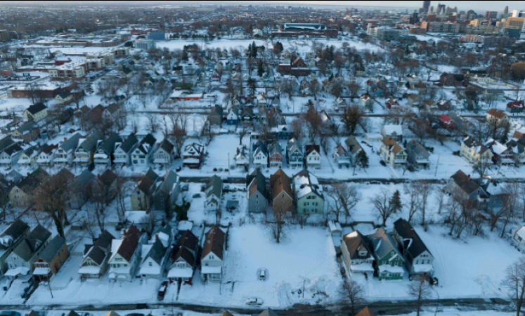
Around the Great Lakes region on the Canadian border, a phenomenon known as "lake-effect snow" takes place in the United States. Buffalo, which is located on the shore of one of the Great Lakes, was severely affected by a deadly snowstorm over the Christmas holiday.
Convection, which results in snowfall, is brought on by the interaction of the warmer water of these lakes and the cold air from the north. Michael Mann stated in a 2018 paper that "the warmer those lake temperatures, the more moisture is in the air, and the greater potential for lake-effect snows." Not surprisingly, as temperatures have risen over the past century, we have seen a long-term rise in lake effect snowfalls.
Also Read: The requirement for COVID testing for Chinese travellers in Canada
On other mechanisms, such as how climate change affects the polar vortex and jet stream air currents, there is disagreement, though.
An air mass called the polar vortex is found high in the stratosphere above the North Pole. The stratosphere is just above the troposphere, where people live.
The cold air in the north and the warmer air in the south are separated from it by a band of rotating air that surrounds it. This band of air starts to undulate and take on a more oval shape as the polar vortex weakens, bringing more cold air south.
This kind of disturbance, which is happening more frequently, is reflected in the following two weeks lower in the atmosphere, where the jet stream is located, according to a 2021 study.
Following the boundary between cold and warm air once more, this air current that blows from west to east then meanders so that cold air from the north can intrude at lower latitudes, especially over the eastern United States.
According to Judah Cohen, the study's lead author and a climatologist for Atmospheric and Environmental Research (AER), "everyone agrees that there is an increase in the probability of severe winter weather when the polar vortex becomes perturbed or disrupted."
Also Read: Multiple casualties are feared following a blast outside Kabul's military airport
He also noted that this "stretched" polar vortex was precisely what was seen just before the storm that struck the United States in December. The same thing happened in Texas in February 2021 during a severe cold snap that resulted in widespread power outages.
The real issue at hand, however, is what is causing the polar vortex to be more disturbed than usual. Cohen claims that they are connected to Arctic changes that have been hastened by climate change. Sea ice is melting quickly on the one hand, and Siberia's snow cover is growing on the other.