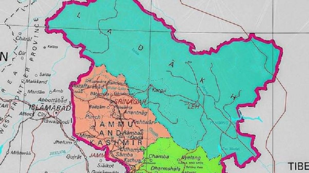
Srinagar: After Jammu and Kashmir and Ladakh have become separate union territories, the central government has released a new map of the country on Saturday. In which 28 states and nine union territories have been shown. In this map, parts of Pakistani occupied Kashmir (PoK) are also shown in Kashmir region. The newly released map shows the division of the erstwhile state of Jammu and Kashmir.
Surprisingly, three districts of Muzaffarabad, Panch and Mirpur have also been given place. Ladakh consists of two districts Kargil and Leh, while 20 districts have also been placed in the Jammu and Kashmir Union Territory. In a gazette notification, the government has also shown the areas of Leh district, Gilgit, Gilgit Wazarat, Chilas, tribal area, Leh and Ladakh, except the existing area of Kargil. This order has been called the Jammu and Kashmir Reorganization Order-2019.
20 districts have been included in the map of Jammu and Kashmir Union Territory, including those areas of Muzaffarabad, Mirpur and Poonch which are under the PoK. In 1947, there were 14 districts in the state of Jammu and Kashmir. These included Kathua, Jammu, Udhampur, Reasi, Anantnag, Baramulla, Poonch, Mirpur, Muzaffarabad, Leh and Ladakh, Gilgit, Gilgit Vajrat, Chilhas and tribal areas.
Also Read:
BJP tightens up about Jharkhand elections, can cut tickets of many MLAs
America's annual terrorism report reveals this about terrorism in Pakistan
Court summons Lalu's daughter Misa in money laundering case, order to appear on 23 November
Former Karnataka CM Kumaraswamy gave a big shock to Congress, said this