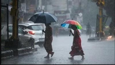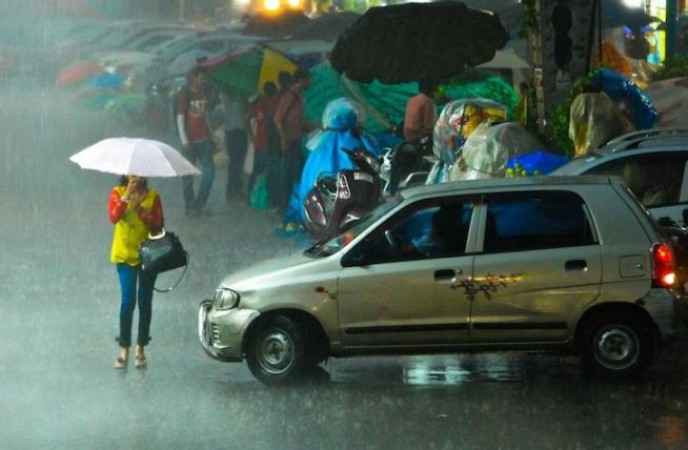
New Delhi: Overnight and early morning, heavy rainfall drenched the national capital while the country hosted the grand G20 Leaders' Summit. The India Meteorological Department (IMD) has forecasted the possibility of light showers continuing into Monday. IMD officials reported that Delhi Radar indicated the persistence of clouds over the entire National Capital Territory (NCT), leading to light rainfall in some areas during the early hours of Sunday.
The Safdarjung observatory, Delhi's primary weather station, recorded a minimum temperature of 23.5°C on Sunday, which is two notches below the usual temperature for this season. According to the IMD's forecast, the maximum temperature is expected to reach around 34°C on Sunday. Safdarjung recorded 38.6mm of rainfall within the 24-hour period starting from 8:30 am on Saturday, while Palam recorded 46 mm of rainfall during the same timeframe. According to the IMD's seven-day weekly forecast, Monday is anticipated to have maximum and minimum temperatures hovering around 34°C and 24°C, respectively, along with the possibility of light rain.
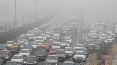
Meanwhile, the city recorded an Air Quality Index (AQI) of 44 at 2 pm on Sunday, showing a slight improvement from the AQI of 54 on Saturday. Mahesh Palawat, the director of the private weather forecasting agency Skymet, attributed the improved air quality to several factors, including strong wind speed, rainfall, and reduced vehicular emissions due to G20 restrictions. Palawat explained, "Strong wind speed helps disperse pollutants. The city has experienced some rain, and the cool wind contributes. Additionally, there is less vehicular traffic due to G20 restrictions, and universities and offices are closed. All these factors have contributed to improved air quality."
The weather department has also predicted heavy rainfall in East Rajasthan, Madhya Pradesh, and Uttar Pradesh until Monday. The IMD noted that the monsoon trough is currently positioned south of its usual location, passing through various regions. Moreover, heavy rainfall is expected in northeast India in the next 3-4 days. Additionally, a new cyclonic circulation is likely to form over the northwest and adjacent west-central Bay of Bengal around September 12, bringing more rainfall. Consequently, rainfall activity is expected to increase over Odisha and Chhattisgarh from September 12. Similar rainfall predictions have been issued by the IMD for Kerala, Mahe, coastal Andhra Pradesh, and Telangana in the coming days.
Himachal Pradesh CM Discusses Flood Aftermath and Relief Package with PM Modi at G20 Summit
Russian Foreign Minister Hails India's Role in Non-Politicizing G20 Summit
PM Modi Proposes Virtual G20 Session for Post-Summit Review