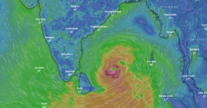
Indian Meteorological Department (IMD) has predicted depression over Southwest Bay of Bengal during the next 48 hours. "A low-pressure area has formed over equatorial Indian Ocean and adjoining central parts of south Bay of Bengal today. It's very likely to concentrate into a depression over Southwest Bay of Bengal during next 48 hours is likely to intensify further during the subsequent 48 hours," said IMD.
As per the IMD forecast, the low pressure area likely to move west-northwestwards towards Sri-Lanka - south Tamil Nadu coast and reach near Tamil Nadu-Puducherry coast on November 25. Due to the low pressure, rainfall activity over south Peninsula very likely to increase from 23rd November with fairly widespread to widespread rainfall accompanied with thunderstorm and lightning is very likely over Tamilnadu, Puducherry and Karaikal and Kerala and Mahe during 24th & 25th November, 2020 and scattered to fairly widespread rainfall accompanied with thunderstorm and lightning is very likely over south coastal Andhra Pradesh and Rayalaseema.
Isolated to scattered rainfall accompanied with thunderstorm and lightning is very likely over Telangana and South Interior Karnataka during the same period. isolated extremely rainfall likely over Tamilnadu, Puducherry and Karaikal on 24th & 25th November, 2020. Isolated heavy rainfall activity very likely over Kerala and Mahe during the same period and over South Interior Karnataka, South coastal Andhra Pradesh and Rayalaseema on 25th November, 2020. Cold wave at isolated places is likely over Saurashtra and Kutch during next 24 hours.
South Tamil Nadu to see heavy rainfall for next 48 hours
Heavy rain in several parts of Tamil Nadu, next 48 hours may experience heavy downpour