The harsh cyclonic storm Phethai is expected to weaken somewhat before landfall due to adverse environmental conditions and cross the coast as a cyclonic storm with a wind speed of 70-90 kmph gusting to 100 kmph. Reports suggested that late on Sunday night, Phethai laid centred 260 km east-northeast of Chennai and 280 km south-southeast of Machilipatnam in Andhra Pradesh.
IMD predicted that it is very expected to cross Andhra Pradesh coast around Kakinada on Monday afternoon.
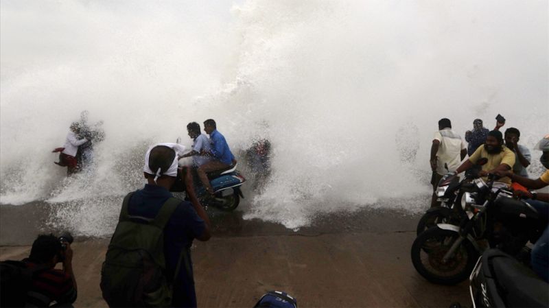
Notably the cyclone is being tracked by DWR Chennai and Machilipatnam apart from Satellite and other observations. Stormy wind speed reaching 50-60 kmph gusting to 70 kmph along and off South Andhra Pradesh, north Tamilnadu & Puducherry coasts is expected to raise gradually becoming gale wind speed of 80-90 kmph gusting to 100 kmph.
Storm heave of height of about 0.5 m to 1.0 m above the astronomical tides are expected to flood the low lying areas of coastal Andhra Pradesh (East & west Godavari, Vishakhapatnam, Krishna and Guntur Districts) and Yanam district of Puducherry at the time of landfall.
Concerning Authorities have been advised to hang up fishing operations along and off Andhra Pradesh coast on Monday. Fishermen have been advised not to endeavor into southwest and westcentral Bay of Bengal and along and off Andhra Pradesh, north Tamilnadu and Puducherry coasts till Monday.
According to reports heavy to very heavy rainfall is likely at a few places in Andhra including areas of east and west Godavari, Vishakhapatnam, Krishna, Guntur, Vizianagaram and Srikakulam districts and Yanam district of Puducherry. Rainfall is also predictable in parts of Odisha, Jharkhand, South Chhattisgarh and West Bengal.