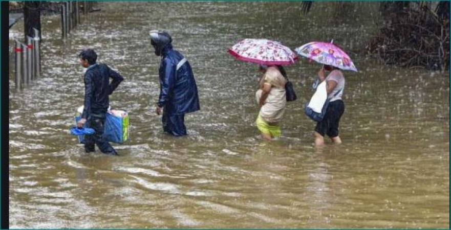
Odisha, which lives on the coast of eastern India due to monsoon, has to face the brunt of the weather. Odisha continues to face the highest rainfall as it has a low area in the North-West Bay of Bengal. Due to monsoon, the sea forms a low pressure area three to four times a month. Due to which most of the cities in Odisha state record the highest rainfall.
According to the Indian Meteorological Department, around July 21, when is the pressure area going to be formed in the North-West Bay of Bengal adjoining the coasts of North Andhra Pradesh and South Odisha. As a result, many cities in the state are likely to receive light and maximum rainfall along with thundershowers and thundershowers by 22nd July. In view of the worsening weather conditions, IMD has issued yellow alerts for several cities in Odisha on July 18 and 19.
The Met department has issued yellow alert for koraput, malkangiri, gajapati, sundargarh, kendujhar and mayurbhanj cities of the state. These cities are likely to receive light rain accompanied by thundershowers and thunderbolts for the next 24 hours. The cities for which yellow alert has been issued on July 19 include Nuapada, Nabarangpur, Kendujhar and Mayurbhanj. Many areas in these cities are predicted to receive the highest rainfall with moderate rainfall. Thundershowers are likely at many places in Malkangiri, Koraput, Nabarangpur, Nuapada, Kalahandi, Balangir, Bargarh, Jharsugudha, Sundargarh, Deogarh and Mayurbhanj districts. Similarly, heavy rainfall is likely to occur in the cities of Kendujhar, Mayurbhanj, Dhenkanal on 20th July.
Tejashwi Yadav opened front against Center regarding inflation tomorrow
Ripun Bora writes to PM Modi, told them a Bangladeshi citizen
Taapsee Pannu says her boyfriend has watched all films, but 'does not understand'