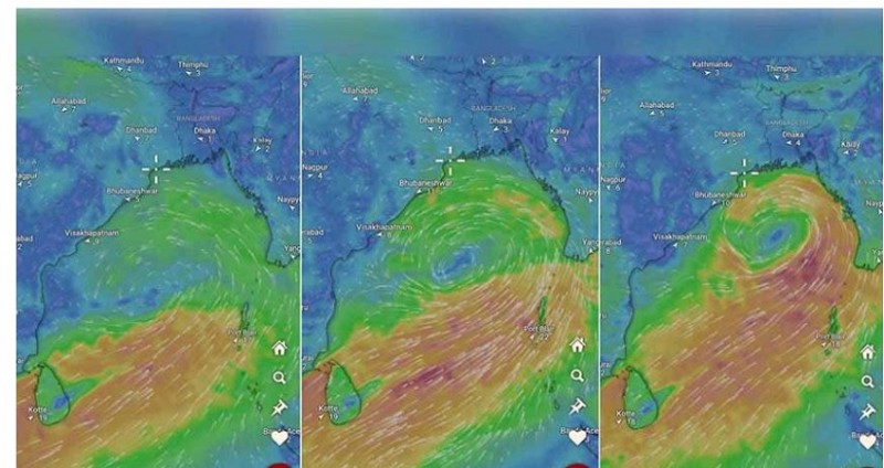
A low-pressure area has been developing over the southwest Bay of Bengal and the adjacent west-central Bay of Bengal near the Tamil Nadu-South Andhra Pradesh coastlines. The India Meteorological Department (IMD) reported this on May 22 and announced that this weather system could intensify into a severe cyclonic storm by May 26.
Current Weather Conditions
This cyclonic activity has already caused thunderstorms and lightning in several parts of West Bengal, including Kolkata, leading to light to moderate rainfall. As of Thursday morning, around 8:30 am, the low-pressure area had moved northeastwards and was situated as a well-marked low-pressure area over the west-central and south Bay of Bengal.
IMD Forecast
Somenath Dutta, head of the Meteorological Training Institute at IMD Kolkata, stated on Thursday: “The low-pressure area is likely to continue moving northeastwards and will likely develop into a depression over the central Bay of Bengal by the morning of May 24. It is expected to intensify further into a cyclonic storm by the morning of May 25 and then move northwards, approaching the coasts of Bangladesh and West Bengal by the evening of May 26 as a severe cyclonic storm.”
Cyclone Name and Predictions
If the cyclone forms, it will be named Remal, meaning sand in Arabic, as per the list of cyclone names provided
Weather Forecast for Kolkata
For Thursday, the forecast predicts a partly cloudy sky with possible rain and thundershowers in some areas of Kolkata. On Wednesday, the city experienced 72.2mm of rainfall accompanied by gusty winds blowing at 40-50 km/h.
Read More:
Cyclone Alert in Odisha: IMD Issues Warning for Fishermen Amid Heavy Rain Predictions
How Torrential Rains in Kerala Have Led to Red Alerts and Four Deaths: Top 10 Updates